GSI has established
more than 1,300 GNSS
Continuously Operating
Reference Stations (GNSS
CORSs) throughout the
country. Movement of the
land of Japan is daily
monitored by GNSS Earth
Observation Network
System (GEONET).
In this page, you can see and download 3 kinds of information on crustal movement detected by GEONET.
 Fluctuation
Vector---Display movement of
the position of GNSS
CORSs in vector
format.
Fluctuation
Vector---Display movement of
the position of GNSS
CORSs in vector
format.
Baseline
Change---Display the change
of baseline length
between two GNSS CORSs
that you select in time
series graphs.
Coordinate
Change---Display the change
of coordinates of GNSS
CORSs in time series
graphs.
If you click the button in this program
after you change
"subject" menu, each
corresponding "How to
use" window will be
displayed.
button in this program
after you change
"subject" menu, each
corresponding "How to
use" window will be
displayed.
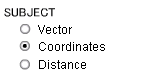 fig.
Selection menu of
Deformation
Information.("subject")
fig.
Selection menu of
Deformation
Information.("subject")
 Notice
Observation data might indicate anomalous large value irrelevant to crustal deformation due to bad conditions such as poor reception of GNSS signal. Be sure to check amount of deformation of several GNSS points around the anomalous point before you use these data. Data might not be displayed if an error is too big or no observation data available.
In this page, you can see and download 3 kinds of information on crustal movement detected by GEONET.
If you click the
button in this program
after you change
"subject" menu, each
corresponding "How to
use" window will be
displayed. fig.
Selection menu of
Deformation
Information.("subject")Observation data might indicate anomalous large value irrelevant to crustal deformation due to bad conditions such as poor reception of GNSS signal. Be sure to check amount of deformation of several GNSS points around the anomalous point before you use these data. Data might not be displayed if an error is too big or no observation data available.
- To change subject, region, period, and scale, select them from the right menu.
- To display a station name and code, put the cursor on the point.
- To display a vector length, click the point.
-
To change
horizontal or
vertical
components,
select the
"DIRECTION"
radio button.

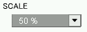
-
To change the
vector scale,
select
"SCALE"
menu and choose
scale.
-
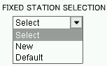
To fix other
observation
station, select
"New"
in the
"FIXED
STATION
SELECTION"
menu.
Then click button,
new displacement
vector map will
be displayed.
button,
new displacement
vector map will
be displayed.
To display initial vector map , select "Default" and click
button.
-
To download
numeric files of
vector data,
click
 button.
-
To download kml
files of vector
data,
click
 button.
- To change subject, district and period, select them from the right menu.
- To select a baseline, click beginning and end point on the map. Selected baselines are added in the list box.
-
To display
baseline
variation graph,
click
 button,
after you select
baseline.(New
window will be
opened)
button,
after you select
baseline.(New
window will be
opened)
-
To cancel a
selected
baseline in the
list box, select
the baseline and
click
 button.
-
To cancel a
selected point
on the map,
click
 button.
- To display a station name and code, put the cursor on the point.
- To display a graph for other baselines, select one from the above pull-down menu.
-
To download
numeric file of
baseline
variation graph,
click
 button.
-
To download
numeric files of
all of baseline
variation
graphs, click
 button.
- To change subject, district and period, select them from the right menu.
- To display a station name and code, put the cursor on the point.
- To add an observation point, click the point on the map. (Selection is possible up to 5 points)
-
To display
coordinates
change graph,
click
button,
after you select
observation
points. (New
window will be
opened)
-
To cancel a
selected point
in the list box,
select the
station name in
the "Output
Observation
Stations"
box and
click
button.
-
To cancel a
selected point
on the map,
click
button.
- To display a graph for other points, select one from the above pull-down menu.
-
To download
numeric file of
coordinates
change graph,
click
button.
-
To download
numeric files of
all of
coordinates
change graphs,
click
button.